Property Record
Burnt Mountain Rd, Jasper, GA 30143


NEARBY LISTINGS FOR SALE OR LEASE
Property Detail
Burnt Mountain Rd
022D-000-024-000
DIST12 LL302,303,310,311 42.50AC
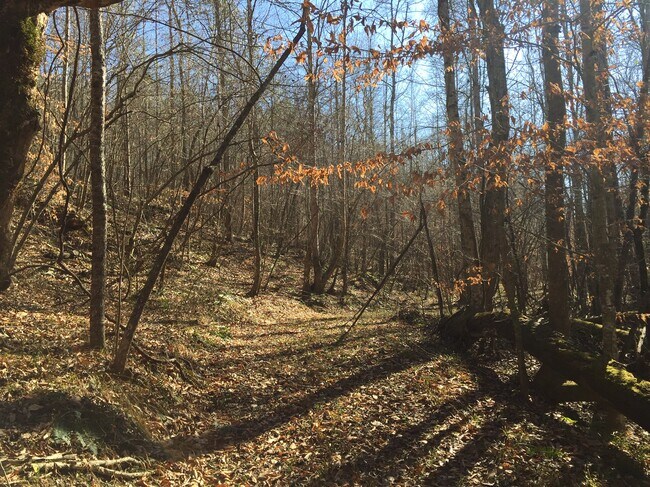
Residentialacreage
Pickens
A
Georgia
13057C0075E
42.50 AC
2024
Pickens County
2024
Atlanta
050202
Atlanta-Sandy Springs-Roswell, GA
DEMOGRAPHICS near Burnt Mountain Rd
1 Mile
3 Mile
5 Mile
2024 Total Population
714
8,164
16,415
2029 Population
787
9,130
18,365
Pop Growth 2024-2029
+ 10.22%
+ 11.83%
+ 11.88%
Average Age
43
43
44
2024 Total Households
296
3,249
6,542
HH Growth 2024-2029
+ 10.14%
+ 11.57%
+ 11.62%
Median Household Inc
$60,968
$67,027
$70,327
Avg Household Size
2.40
2.40
2.40
2024 Avg HH Vehicles
2.00
2.00
2.00
Median Home Value
$305,000
$231,144
$261,121
Median Year Built
1996
1990
1992
Nearby Places
Map Layers
Map Styles
 Street
 Aerial
- Restaurants
- Banks
- Shops
- Fitness
- Groceries
SALE & LEASE HISTORY
LISTING DATE
SALE/LEASE

Oct 07, 2016
For Sale
Apr 07, 2020
For Sale
Nearby Properties
Address
Land Use
TOTAL SIZE
Lot Size
Zoning
Address
Land Use
TOTAL SIZE
Lot Size
Zoning
149,347 SF
18.16 AC
C-2
Address
Land Use
TOTAL SIZE
Lot Size
Zoning
40,482 SF
1.84 AC
CBD
Address
Land Use
TOTAL SIZE
Lot Size
Zoning
66,768 SF
19.43 AC
R-1
Address
Land Use
TOTAL SIZE
Lot Size
Zoning
9,120 SF
12.06 AC
R-1
Address
Land Use
TOTAL SIZE
Lot Size
Zoning
104,608 SF
10.12 AC
C-2
Address
Land Use
TOTAL SIZE
Lot Size
Zoning
70,300 SF
5.06 AC
C-2
Address
Land Use
TOTAL SIZE
Lot Size
Zoning
51,709 SF
6 AC
C-2
Address
Land Use
TOTAL SIZE
Lot Size
Zoning
82,500 SF
6.34 AC
C-2
Address
Land Use
TOTAL SIZE
Lot Size
Zoning
19,541 SF
3.12 AC
C-1
Address
Land Use
TOTAL SIZE
Lot Size
Zoning
9,670 SF
9.73 AC
C-2
Address
Land Use
TOTAL SIZE
Lot Size
Zoning
20,461 SF
3.71 AC
M-1
Address
Land Use
TOTAL SIZE
Lot Size
Zoning
5,928 SF
5 AC
M-1
Address
Land Use
TOTAL SIZE
Lot Size
Zoning
27,440 SF
4.71 AC
C-2
Address
Land Use
TOTAL SIZE
Lot Size
Zoning
22,360 SF
28.31 AC
M-1
Address
Land Use
TOTAL SIZE
Lot Size
Zoning
14,736 SF
2.32 AC
CBD
Address
Land Use
TOTAL SIZE
Lot Size
Zoning
23,000 SF
4.34 AC
C-2
Address
Land Use
TOTAL SIZE
Lot Size
Zoning
26,065 SF
7.87 AC
C-2
Address
Land Use
TOTAL SIZE
Lot Size
Zoning
49.14 AC
R-3
Address
Land Use
TOTAL SIZE
Lot Size
Zoning
63,947 SF
10.38 AC
M-1
Address
Land Use
TOTAL SIZE
Lot Size
Zoning
4,176 SF
0.92 AC
C-2
Address
Land Use
TOTAL SIZE
Lot Size
Zoning
5,880 SF
5.67 AC
R-3
Address
Land Use
TOTAL SIZE
Lot Size
Zoning
15.72 AC
C-2
Address
Land Use
TOTAL SIZE
Lot Size
Zoning
12,680 SF
4.62 AC
C-2
Address
Land Use
TOTAL SIZE
Lot Size
Zoning
1,247 SF
10 AC
R-1
Address
Land Use
TOTAL SIZE
Lot Size
Zoning
24,408 SF
3.62 AC
M-1
Address
Land Use
TOTAL SIZE
Lot Size
Zoning
16,789 SF
6.44 AC
C-2
Address
Land Use
TOTAL SIZE
Lot Size
Zoning
13,078 SF
1.32 AC
CBD
Address
Land Use
TOTAL SIZE
Lot Size
Zoning
33,793 SF
3.31 AC
C-2
Address
Land Use
TOTAL SIZE
Lot Size
Zoning
29,094 SF
1.34 AC
C-2
Address
Land Use
TOTAL SIZE
Lot Size
Zoning
21,740 SF
7.31 AC
C-2
The World's #1 Commercial Real Estate Marketplace
Connect with us
© 2025 CoStar Group
The information above has been obtained from sources believed reliable. While we do not doubt its accuracy we have not verified it and make no guarantee, warranty or representation about it. It is your responsibility to independently confirm its accuracy and completeness. Any projections, opinions, assumptions, or estimates used are for example only and do not represent the current or future performance of the property. The value of this transaction to you depends on tax and other factors which should be evaluated by your tax, financial, and legal advisors. You and your advisors should conduct a careful, independent investigation of the property to determine to your satisfaction the suitability of the property for your needs.